GOHSEP 2010 dataset added June 18, 2016
The GOHSEP 2010 imagery has been added to the new Atlas site as downloads and as a web service basemap. The imagery was provided to Atlas as individual parish mosaics with the boundary images clipped to exclude parts of the quad not contained with the parish boundary. Therefore, to get a complete image of a quad […]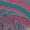
2008 DOQQ coastal imagery added June 16, 2016
A collection of MrSid files not available on the old Atlas site has been added here: the 2008 DOQQ coastal imagery dataset. The images cover parts of Louisiana, Mississippi, and Alabama at 1-meter resolution in color infrared and true color. Both products are available for download and as web services. See the map or dataset […]
USGS digital raster graphics added June 14, 2016
Atlas’ collection of scanned USGS topographic maps, or digital raster graphics (DRG), are now accessible through a new map downloader and FTP site. The historical DRGs are mostly from 1998 and are in TIFF format. The collection includes a set of “updated” sheets for 74 quads around the state. The scans are a little higher quality and […]