
2008 DOQQ coastal imagery added
June 16, 2016
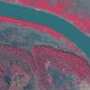 A collection of MrSid files not available on the old Atlas site has been added here: the 2008 DOQQ coastal imagery dataset. The images cover parts of Louisiana, Mississippi, and Alabama at 1-meter resolution in color infrared and true color. Both products are available for download and as web services. See the map or dataset page.