
2015 USGS Topo Maps added
November 8, 2016
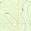 Atlas has added Louisiana’s 2015 “topos” to its collection of USGS topographic maps. The 2015 maps are accessible through a new map downloader and FTP site. The maps are in PDF format, as provided to the Cartographic Information Center (Map Library) at Louisiana State University, who provided the dataset to Atlas. See the dataset details page for more information.
Unlike most of the other datasets recently added to Atlas, the maps were not compiled into a mosaic web service. However, Esri provides a topo basemap compiled from USGS topo maps (different from Esri’s “Topographic” basemap. See the “USA Topo Maps” basemap in ArcGIS Desktop and ArcGIS Online.