Search for:
Toggle navigation
About Atlas
Updates & Announcements
Datasets & Maps
Help with Atlas & GIS
Tags
3d
coastal
color infrared
contours
dem
digital raster graphic
doqq
drg
elevation
gohsep
high-resolution
imagery
landsat
lidar
louisiana
raster
richland parish
rpao
topographic
usgs
vector
Get additional help
Datasets tagged "gohsep":
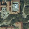
GOHSEP Aerial Imagery
This dataset contains statewide Digital Orthophoto Quarter-Quarter Quadrangle (DOQQQ) imagery provided by the Louisiana Governor’s Office of Homeland Security and Emergency Preparedness (GOHSEP).