
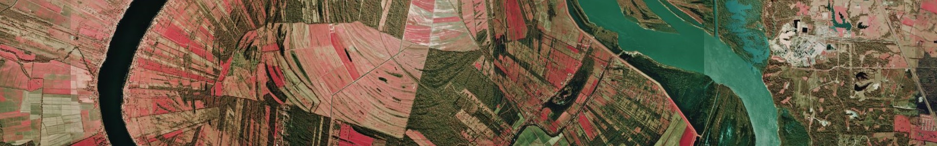
Digital orthophoto quarter quadrangle (DOQQ) color infrared imagery of Louisiana taken in 1998 at 1-meter resolution.
Metadata
Collection date: 1998
Resolution: 1 meter
Coverage: Louisiana
Downloadable data format: MrSid
See the metadata included in each zip for specific details on that image.
Notes
This dataset contains orthophotos of USGS quarter-quads in Louisiana created from color infrared aerial photography film. This image has an overedge of approximately 300 meters on all sides, so the area encompassed is actually somewhat larger than 3.75 minutes by 3.75 minutes. Each pixel in the orthophotos represents an area of one square meter on the ground. The images are in Multi-Resolution Seamless Image Database (MrSID) format.
Archive Contents
The metadata for this image are encapsulated into several documents in each quarter-quad’s zip archive:
xxxxxxxx_xxs_50.mtd – metadata in mp (metadata parser) compatible ASCII text form
xxxxxxxx_xxs_50.html – metadata in HTML form
xxxxxxxx_xxs_50_faq.html – metadata presented as Questions and Answers
xxxxxxxx_xxs_50.sgml – metadata in SGML form
xxxxxxxx_xxs_501.jpg – thumbnail of image
xxxxxxxx_xxs_502.jpg – larger view of image
The image is accompanied by a georeferencing ‘world’ file. Following the ArcView/ArcInfo convention for such files, the xy origin specified in this file refers to the center of the upper left hand pixel of the image. You should have received the following as part of the dataset:
xxxxxxxx_xxs_50.sid – image in 50:1 compressed MrSID form
xxxxxxxx_xxs_50.sdw – world file for image
The files are prefixed with a letter indicating the following:
c – color infrared image with no other special designation (most common)
k – over the area of the Kisatchie National Forest with no identical product available from the USGS
m – positioned on the Mississippi-Louisiana border no identical product available from the USGS
t – positioned on the Texas-Louisiana border with no identical product available from the USGS
z – mostly or completely water