
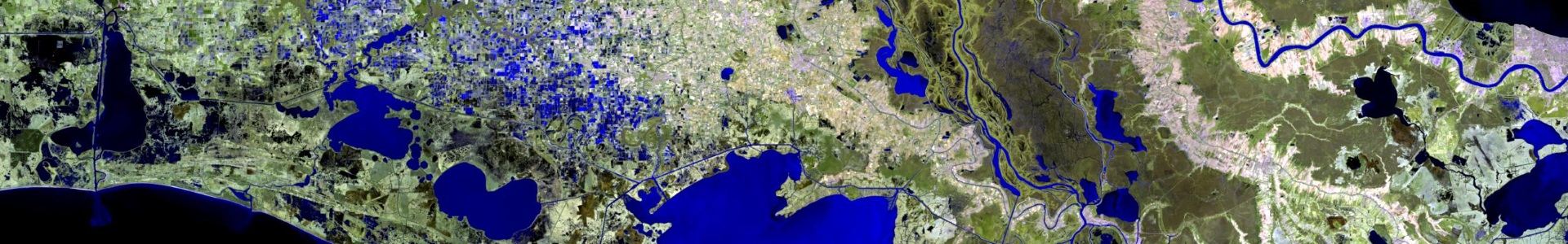
A mosaic of fourteen Landsat 8 OLI satellite scenes acquired during the winter of 2013-2014. The pansharpened mosaic has a resolution of 15 meters.
Metadata
Collection dates: December 16, 2013 – March 13, 2014
Resolution: 15 meters (pansharpened)
Coverage: Statewide
Image format: GeoTIFF
Additional metadata: landsat8oli_rgb764_panmerge_mosaic_louisiana_ldwf_2014_t_FGDC.xml
Map Viewer
Preview the dataset in this interactive web map of the Landsat 8 Mosaic 2014.
Download
landsat8oli_rgb764_panmerge_mosaic_louisiana_ldwf_2014_t.zip (2.8 GB)
Notes
This dataset is a mosaic of 14 Landsat 8 OLI satellite scenes acquired during the Winter of 2014. The mosaic was created using bands 7 (mid-IR), 6 (near-IR), and 4 (red visible) in RGB sequence merged with the panchromatic band. The final mosaic was trimmed to the Louisiana state boundary, and is in 15 meter spatial resolution in 16-bit format. The data were collected to provide an updated satellite image of Louisiana to be used in GIS and remote sensing analysis of land cover conditions related to an array of activities supported by Louisiana Sea Grant and related sponsors and users.