
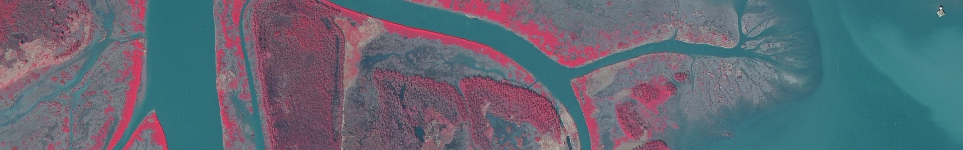
Digital orthophoto quarter quadrangle (DOQQ) imagery of coastal areas of Louisiana, Mississippi, and Alabama, created in 2008. The dataset includes true color and color infrared layers.
Metadata
Collection date: 2008
Resolution: 1 meter
Coverage: Coastal Louisiana, Mississippi, and Alabama
Downloadable data format: MrSid
Metadata included with imagery
Notes
The imagery contained in this dataset was created by Photo Science, Inc., as part of a project funded by the Coastwide Reference Monitoring System (CRMS) and the U.S. Geological Survey. The image is a digital orthophoto quarter quadrangle (DOQQ), which is a raster image in which displacement in the image caused by sensor orientation and terrain relief has been removed and combines the image characteristics of a photo with geometric qualities of a map. To create the image, Photo Science, Inc., used digital mapping camera (DMC) technology which allows for the creation of four components: digital imagery (non-georeferenced pan 1 meter and non-georeferenced Red, Green, Blue, and IR 4 Band 1 meter), aerotriangulation solution for stereo creation, stereo pair generation (4.75 meter stereo images), and 4 Band digital orthophotography (1 meter 4 Band DOQQs).