
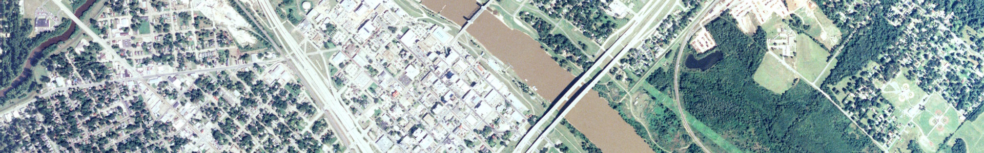
Digital orthophoto quarter quadrangle (DOQQ) color infrared imagery of Louisiana taken in 2007 at 1-meter resolution.
Metadata
Collection date: 2007 (individual acquisition date in file name)
Resolution: 1 meter
Coverage: Louisiana (partial)
Downloadable data format: GeoTIFF
Notes
2007 DOQQ NAIP images delivered September 2008.
This partial mosaic is provided as-is based on an incomplete collection of images. The images are being put online as part of an Atlas project to create publicly available datasets from Louisiana GIS and remote sensing data, including those that are incomplete or lack metadata. These datasets were typically stored offline and not readily accessible. The project aims to put these inaccessible datasets online despite incomplete coverage and metadata.
If you have information that could improve this dataset, please contact gis@lsu.edu.